
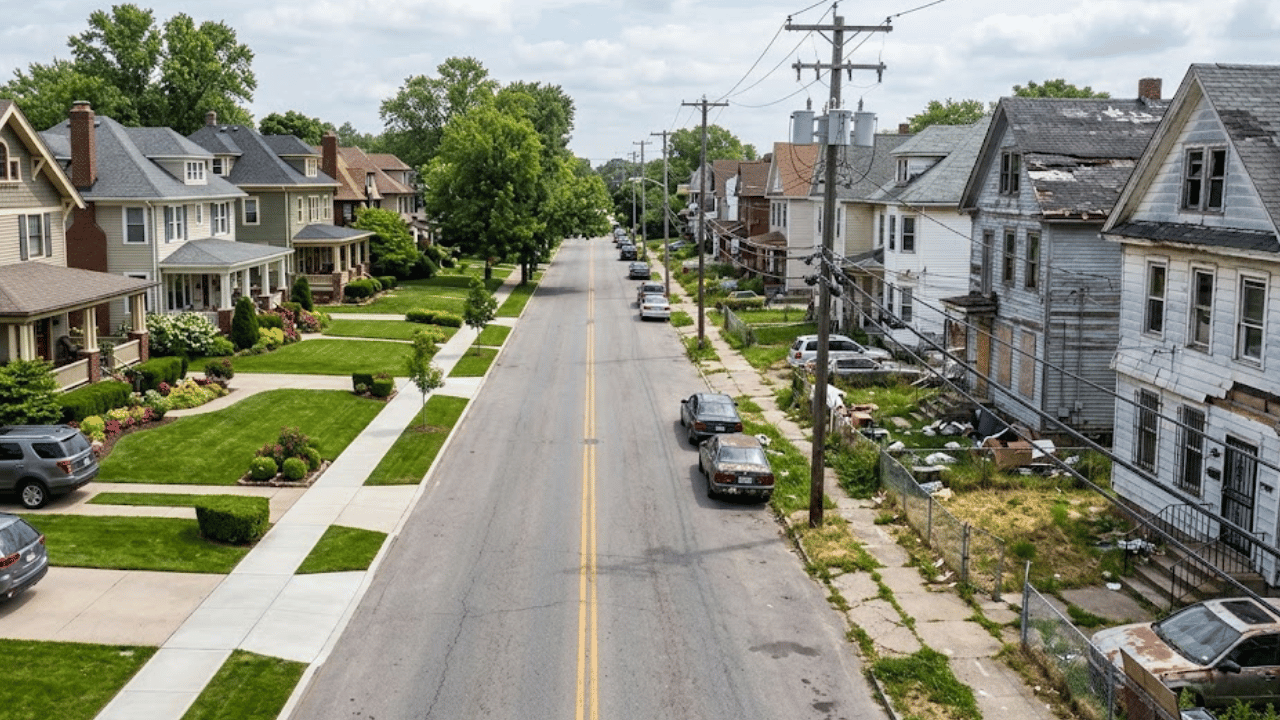
Walk a few blocks in almost any city and the vibe can shift completely. One street has porch lights, kids on bikes, and neighbors waving. Turn the corner and it’s quieter, darker, maybe a little tense. Same zip code, totally different feel.
That’s why neighborhood reputations can be so misleading. A whole area gets labeled safe or dangerous based on a few headlines or a friend’s offhand comment, even though conditions can change dramatically from one block to the next. Reality is usually more complicated than reputation.
Anyone house hunting, apartment shopping, or just curious about their city deserves better information than gossip. Looking past broad labels and paying attention to local details helps people see a place more clearly, and more fairly, than any single ranking ever could.
What Crime Statistics Actually Reveal About a Neighborhood
Crime data can be useful, but only when it’s read carefully. Comparing neighborhoods in Indianapolis means looking at which offenses are being counted, over what period, and how those numbers relate to the number of people living or passing through. Raw totals rarely tell the whole story.
Offense categories matter a lot. A neighborhood with many reported thefts from cars may have a very different reality than one with fewer, but more serious, violent incidents. Lumping every offense into one big number hides the differences people actually care about.
Reporting patterns also shape the data. Some crimes go unreported, and reporting rates can vary by area. Busy commercial districts may show more incidents simply because more people pass through them each day, not because residents face higher risks at home. Context changes the meaning.
Why Two Nearby Streets May Have Different Experiences
Traffic patterns play a surprisingly big role. A main road with constant cars and buses can see more collisions, more foot traffic, and more opportunities for certain crimes. A quiet residential side street just a block away might feel entirely different day to day.
Commercial activity shapes things too. Bars, convenience stores, and late-night businesses draw crowds at hours when residential areas are asleep. That activity isn’t automatically bad, but it can change the rhythm of a street and the kinds of incidents that get reported nearby.
Physical conditions matter as well. Lighting, vacant buildings, well-kept parks, and sidewalks all influence how a space feels and how it’s used. A brightly lit block with busy porches can feel very different from one where streetlights have been out for months.
The Problem With Labeling Entire Areas Dangerous
Broad labels flatten real differences. Calling an entire area dangerous ignores the quiet streets, longtime homeowners, and thriving small businesses that exist inside it. One incident on one corner can end up defining thousands of people who had nothing to do with it.
Labels can also reinforce stereotypes. Reputations sometimes track race, income, or old news more than current conditions. That can affect property values, investment, and how outsiders treat residents, creating a cycle that’s hard to break even when conditions improve. Reputations stick long after facts change.
Most importantly, labels misrepresent everyday life. People in so-called rough areas still walk dogs, grill on weekends, and take kids to school. Their experiences rarely match the dramatic picture painted from the outside. Real neighborhoods are made of real people, not rankings.
How to Evaluate Neighborhood Safety More Intelligently
Start with recent official data rather than old headlines or anonymous forum posts. Local police and city sources often publish crime information that can be filtered by area and time period. Fresh, verified numbers paint a more accurate picture than outdated reputations.
Compare crime types and trends, not just totals. Is property crime rising or falling? Are incidents concentrated on one commercial strip? Looking at changes over several years helps separate lasting patterns from a single unusual month that might skew the overall picture.
Then go see it in person. Visit in the morning, afternoon, and late evening. Walk the block, notice the lighting, and talk to people who live there if possible. Neighbors usually know more about a street than any map or ranking could reveal.
Conclusion
Safety can change from one block to the next, which is why broad reputations so often miss the mark. Two streets a few minutes apart can feel completely different, shaped by traffic, businesses, lighting, and the people who live there.
Crime statistics help, but only when they’re read with context. Offense types, reporting patterns, population differences, and trends over time all matter. Labels that ignore those details can mislead newcomers and unfairly stigmatize entire communities. Numbers need someone asking the right questions.
A neighborhood is more than its crime ranking. Recent data, personal visits, and honest conversations with residents give a fuller picture than any list or label. That approach leads to smarter decisions and fairer views of the places people call home.


